Pacific Crest Trail
&
Fall 2009
Denis Kertz, ©2009
Day 22: Mon, Sep 28, 2009 - Weed, CA to Lake Britton , CA
There was only one breakfast place, up the road at the
other motel. I had a stack of 3 pancakes
that were good and relatively inexpensive at $6 which included coffee. As I was getting ready to leave on my bike
outside another cyclist who must have been eating breakfast also asked me about
my trip. He really got excited when I
said I planned to ride through
I rode up the street a few miles until I was forced to get
on I5 until the next exit where I picked up
I rode a few more miles and entered the town of
Initially, 89 had an okay shoulder which was a good thing
because 89 was a major road and there were some logging trucks running back and
forth. Shortly I started the climb to
McCloud Summit at 4,470 feet. It was a
fairly hard climb, between 4-5 mph, until the last mile which eased off quite a
bit. From there it was a quick 5 mile
descent to the town of  with another view of Mt Shasta. I found
a coffee shop with WiFi in a mercantile building so I checked on some work
status. I also ran into a guy who asked
me about my Rohloff hub which he was deciding whether he could justify buying
one for his bicycle. After that I picked
up a few things at the grocery store and grabbed a bite to eat at a food mart.
with another view of Mt Shasta. I found
a coffee shop with WiFi in a mercantile building so I checked on some work
status. I also ran into a guy who asked
me about my Rohloff hub which he was deciding whether he could justify buying
one for his bicycle. After that I picked
up a few things at the grocery store and grabbed a bite to eat at a food mart.
It was about 1:30 when I started riding again but now 89 had no shoulder and I had to watch traffic more closely. There was a gradual climb of about 1,200 feet to Dead Horse Summit at 4,533 feet. However, there were some rollers in this stretch that grew tiresome with a descent that would lose some altitude followed by a climb to regain the altitude. So the climb was really harder than the simple altitude difference between McCloud and the summit.
After what seemed like a lot of riding I finally crested
the summit at 4:00 and began a somehwat uneven descent to
Near 5:30 I descended down to
Day 23: Tue, Sep 29, 2009 - Lake
Britton , CA
I never did find out what a Hiker-Biker site cost so I
left $8 under the assumption that hiker-biker sites are supposed to be somewhat
less expensive than regular sites. I
also got a good view of
It was an overcast morning and cool on the way to Hat Creek about 15 miles away. It was also fairly flat so I made reasonably good time. There was supposed to be a store in Hat Creek where I hoped to have a second breakfast but the store next to the post office was closed and it didn't look like much of a store. That was depressing but then just down the road I found a small cafe in an A frame and had a good breakfast of bacon, egg, and pancakes. It was especially good because I didn't figure on finding anything more than a store although there was a small store next to the cafe as well.
A while later I passed by an RV Park that had a combined store/cafe so I could have gotten some food there as well although I might have been too late for breakfast. I rode on to Old Station which was about 9 miles past Hat Creek. I also rode by several miles of forest fire damage along the road that happened just a couple of months ago. I stopped in Old Station for some groceries and a bite to eat and got a free turkey sandwich that was dated to be sold by yesterday so the owner gave it away.
When I left Old Station I almost bought the farm. I had been following the actual Hat Creek which reportedly has good fishing. I passed by an angler and decided I should take a photo. When I did a U-turn to get in a better position for a photo I wasn't that far in front of an oncoming vehicle. I don't know if I didn't pay enough attention or if the vehicle was traveling fast and coming around a corner didn't give me much warning. Then when I was ready to turn around back in the original direction I started turning just as another vehicle came around the corner. I saw the vehicle so aborted the turn and never was in danger there although I'm not so sure the oncoming vehicle would have agreed. Finally I got my angler photo.
A little further on I passed another RV Park and I stopped at this because I reminded myself that RV Parks often have WiFi. This one did so I connected up for the price of chocolate milk, under the theory that one should patronize the place if using their WiFi. In this case I only wanted to verify that a work issue had been resolved based on an outdated java version on our new database server and a later java version fixed the problem and it was nice to have that confirmation.
Although the climbing was never that steep with only some
fairly steep climbing towards the end, I ended up gradually climbing almost
3,000 feet when I crested the Eskimo Hill Summit at 5,926 feet. Very shortly after that 89 turned left and I
followed and entered Lassen Volcanic NP.
I stopped at the information displays and then continued on another
couple of miles. Since I had a
 I visited the
I stayed at the
After I set up camp I retired to my tent to be warmer. As I was typing my notes I started hearing patter on my tent like it was raining. Surprised, I looked out and found the patter was caused by very small hail. It started coming down harder and there was some thunder as well. When I looked outside there was a film of small hail covering the ground and I patted my tent walls to shed the hail.
Day 24: Wed, Sep 30, 2009 - Lassen Volcanic NP, CA to Lassen Volcanic NP, CA [30.2, 4:18:31, 7.0 mph, 3,076']
It was a cold night and the 27F forecast sounded about right. I had on a T-shirt, long sleeve jersey, tights, and socks and it was just enough to be fairly comfortable. In the morning I lingered in my sleeping bag because I didn't want to face the morning until the sun came out. Even with the sun out it was hard for the sun to get in the campground because of all the pine trees. I ate breakfast in my tent and then packed up to face the world.
By the time I was done packing the camp store was open and I stopped by for a coffee, not because I particularly wanted coffee but because I wanted a hand warmer. By the time I left around 9:45 it wasn't too bad in the sun. I wore a short sleeve jersey, long sleeve shirt, fleece vest, and light jacket along with my tights and socks. It was a cloudless sky and I was fine in the sun and a little chilled in the shade.
Lassen Volcanic NP features Lassen Peak, the largest plug
dome volcano in the world and the southern most volcano in the
It was 22 miles to the Lassen Summit at 8,512 feet. Aside from an initial one mile climb and 2
mile descent it was a pretty gradual climb of approximately 3,000 feet. The good thing about this climb is there was
a variety of scenery and several opportunities to stop along the way, which
broke up the climb and kept it from being just a grind it out climb. In short, more enjoyable than a lot of the
other climbs. There was a view of Chaos
Crags, a group of lava domes, and distant views of a lake that I learned later
was 
I stopped at the Devastated Area, so named because the
volcanic eruption had devastated the area although that wasn't obvious any
longer. This area had a view of the
north side of
After the King's
Since I didn't make the summit until almost 2:30, I passed on any side trips. It was a scenic, steep, winding descent that I held down to about 15 mph because I didn't feel the need for any more wind chill. At the southern park boundary there was a visitor center that I thought initially was closed. There was also a walk-in campground there as well. Since the visitor center had some food and it was still a ways to the next campground, with the possibility that it could be closed, I deemed it prudent to take advantage of the food and the campground and not push my luck. I ended up with a small pizza and a soda for $8 which wasn't too bad considering the location. The pizza was a frozen pizza heated up so it certainly wasn't gourmet but it was food. After eating I stayed a little longer to enjoy the heated building.
The walk-in campground was a pretty decent deal at $14 with drinking water and flush toilets and no vehicles. Actually most walk-ins had vehicles but they were parked in the visitor center's parking lot and they had to carry everything into their campsite, which wasn't that big a deal since they could park pretty close to the campsite. I did my best to pick a site that was high enough and open enough to get both the evening and morning sun. The forecast was for it to actually be a little colder tonight since there was no cloud cover.
Day 25: Thu, Oct 01, 2009 - Lassen Volcanic NP, CA to Quincy , CA
It was not as cold overnight as the previous night, at least 5F warmer. I waited for the sun to make its way over the hill and shed its light on the campground before I got up. I made one last visit to the visitor center and hit the road around 9:30, noticeably warmer than yesterday morning at the same time and at about the same altitude.
The day would be spent mostly descending, losing about
3,000 feet but with some climbing at the end. After a quick 5 mile descent I reached the
junction with 36. From that point I was
facing regular traffic again (most commercial traffic was prohibited through the
park) on Hwy 89 with an irregular shoulder.
In about another 5 miles I reached Child Meadows where there was a small
resort with a cafe open for breakfast.
Had I known a breakfast place was this close I would have hit the road
sooner. I had 3 pancakes and they were
possibly the best of the trip. They
weren't the biggest but they were the fluffiest and the total with coffee came
to $7.
After a quick 5 mile descent I reached the
junction with 36. From that point I was
facing regular traffic again (most commercial traffic was prohibited through the
park) on Hwy 89 with an irregular shoulder.
In about another 5 miles I reached Child Meadows where there was a small
resort with a cafe open for breakfast.
Had I known a breakfast place was this close I would have hit the road
sooner. I had 3 pancakes and they were
possibly the best of the trip. They
weren't the biggest but they were the fluffiest and the total with coffee came
to $7.
The road continued a modest descent with only one section
of a modest climb. The road passed
through some nice meadows in addition to pine forest. Near
About half way along the length of the lake I detoured towards the lake about a mile for some food. While there I noticed two deer munching away on the grass behind a restaurant. Of course, that's when my camera chose to tell me that my 2G SD memory card was full and the deer moved out of view as I changed to a new memory card. However, when I rode to the opposite end of the restaurant the two deer were still munching away. One deer was smaller than the other and somewhat skittish when I appeared but the larger deer wasn't fazed at all. I got my photo and returned to the road.
In another 5-6 miles I reached the dam that created the
lake and then I started a descent of about 1,000 feet on my way to
After this modest climb I began descending again and reached Crescent Hills which was a town of 300 or so and had nothing. That was no big loss since this had been an easy day so far with mostly descending and easy pedaling.
Just outside Crescent Hills the character of the ride changed totally. It looked like I was heading right into a large hill and due for some climbing but I rode into a nifty canyon that wound its way through two huge hills, following Indian Creek. This section of the road required more careful navigation because most of the time I was hemmed in by a hill on my side with no bail out room. However, I was descending so I spent less time in any potentially difficult section. That soon changed.
After an easy descent through this neat canyon I reached
the junction with 70. Hwy 89 was heading
west at that point through the canyon and now 89 abruptly turned south towards
Finally, I was riding through a section with a guardrail right next to the edge a bend in the road and I saw a big truck coming from the other direction and then I heard a big truck coming up behind me. I had either the option of growing bionic legs that would suddenly accelerate me and keep me ahead of the truck behind me, which didn't happen, or stop and press myself up against the guardrail, which is what I did. As luck would have it, the truck behind me was pulling a trailer. I could only watch as it drove past. The front of the truck cleared me easily but I could see the rest of the train was getting closer and closer as the truck followed the bend in the road. I could only watch as the rear wheels of the trailer could have only cleared me by about 2 feet, much too close for comfort.
After a few more miles with some ups and downs I finally cleared the canyon only to be confronted with another challenge. After fighting traffic I was now faced with dogs. I heard a couple of dogs barking in the distance and then I saw them racing up a gravel driveway to “greet” me. When they got to the road they turned and started running towards me. As a cyclist you never know what the intentions are of dogs, just being territorial or intending worse. Not waiting to find out I immediately started yelling “Go Home!” as loudly and forcefully as I could. After several yells, the two dogs, black border collies, were confused. Weren't they on their home territory? Why were they being yelled at? Confused, they halted, turned around, and started running. I kept up the yelling and one dog was so confused while he was trying to escape that he ran into a white picket fence that lined the driveway. Maybe those dogs learned a lesson today – that not all cyclists are pansies and easily intimidated.
The rest of the way into town was uneventful.
After I settled in I ate at a Subway which again had the $5 foot long Buffalo Chicken special and then settled in my motel for the night.
Day 26: Fri, Oct 02, 2009 - Quincy , CA to Sierraville ,
CA
I spent a little time in the morning checking out weather
forecasts for the upcoming days. Today
was Friday and Sunday was predicted to have a few showers so that gave me some
urgency to get to
I rode to the Courthouse Cafe on
I didn't actually leave until almost 10:00 and started
some immediate climbing. The day would
be spent mostly climbing but with only a couple of significant climbs. I didn't find anything in
After a very late second breakfast around 1:00 I rode on. I rode through a couple valleys surrounded by hills populated with pine trees and ranches with horses and cattle in the valley. The price for these views was I had to climb out of the valleys, both a little over 1,000 feet of climbing. Riding through the second valley brought me to Sierraville that had a couple of restaurant/cafes and a grocery store. I stopped for my final break before riding on another 4 miles, climbing of course, to the Cottonwood CG. By this time it was around 5:00 and the traffic was getting heavier, probably weekenders trying to get to their favorite get away places. I would have liked to push a little further but I still had about another 600 feet of climbing and I was growing concerned with the traffic with everybody seemingly in quite a hurry on a major road with little or no shoulder.
So I made the decision to stop at
Day 27: Sat, Oct 03, 2009 - Sierraville , CA to Camp
Richardson , CA
It wasn't particularly cold overnight but I dressed for cold so I was pretty toasty. I retrieved my food bag and had breakfast in bed. Then I lingered in my tent waiting for the sun to come up.
I left around 8:40 and immediately resumed the climb I had started yesterday. It was another 4 miles of climbing that took about 40 minutes. After an hour I had traveled 7 miles and rode by the first of the two Little Truckee CGs which is where I would have liked to stay last night.
There was some more up and down on the road that wasn't in very good shape. There was no shoulder and the edge of the road was often cracked. There were also cracks across the road that made descending rougher than it should have been. It was bad enough that I came very close to losing my GPS. The Garmin 60CSx handlebar mount is poorly designed and I used a rubber band to keep the GPS in its mount but I came very close to losing it on one descent. I had to do an emergency stop and then I used a second rubber band to hold it in securely.
I was hoping I could make
When I left the wind was blowing fairly strong and
gusting. That was a concern. My goal for the day was to make it to the
south end of
There was a lot of traffic through town on a Saturday that
apparently had a wine tasting event going on, based on folks strolling through
the downtown with wine glasses in hand.
I rode on
The path delivered me to
The path started out great in
There were still some occasional views of the lake and
then the road started its climb to the very scenic  This was a steep, couple mile climb that then
descended along the contour of the bay with a vista point. This was a great view of the bay and was well
populated with tourists. Leaving the bay
required climbing out along the contour of the bay on the other side to another
vista point called Inspiration Point with more inspiring views.
This was a steep, couple mile climb that then
descended along the contour of the bay with a vista point. This was a great view of the bay and was well
populated with tourists. Leaving the bay
required climbing out along the contour of the bay on the other side to another
vista point called Inspiration Point with more inspiring views.
There was a campground right across from Inspiration Point
that I briefly considered but the sky was clouding up and it was getting quite
chilly. I expected it would be a very
chilly night. Worse, the threat of
rain/snow showers made the idea of packing up and descending from this
elevation in the morning unattractive or perhaps dangerous. So I made the steep descent with several U
turns in the road and rode a few miles further to
Then I walked to a bar and grill on the beach. The sign-in clerk said it was possible to follow a trail to the beach road rather than have to walk back to the highway and get on the road from there. So I set off and shortly began wondering what I was getting into with no obvious trail. Fortunately, it was getting near dark and there were some lights that I aimed for and they delivered me almost to the door steps of the bar/grill. I had a basic chicken sandwich and a beer, oddly my first beer of the trip.
From the bar/grill I walked back to the highway to the
hotel where I signed up for a tent site.
I was rather disappointed to find out
Day 28: Sun, Oct 04, 2009 - Camp Richardson ,
CA to South
Lake Tahoe , CA
It was snowing when I was ready to get up in the morning
so I lingered a while in my tent. Around
7:30 I left while it was still snowing. I donned my rain gear, never dreaming that my
first use of rain gear on this trip would be for snow, and walked to the camp’s
store/cafe and had a breakfast sandwich.
By the time I had eaten the snow had stopped.
I donned my rain gear, never dreaming that my
first use of rain gear on this trip would be for snow, and walked to the camp’s
store/cafe and had a breakfast sandwich.
By the time I had eaten the snow had stopped.
Last night I when inquired about WiFi the desk guy told me they didn't have WiFi but there was a coffee shop with WiFi about a half mile down the road. The road was pretty messy and a half mile wasn't very far so I chose to walk. Although I only have sandals for shoes I have SealSkinz socks that are water proof and they were okay for walking through some snow. Except it wasn't a half mile – it was 2.5 miles. Amazing that someone could be that far off, by a factor of 5 in this case. But I walked it and my only concern was I needed to decide whether I was staying at the camp or leaving and had to be gone by noon if I was leaving. Walking 5 miles roundtrip cut into that decision time.
When I got to the cafe I thought at first I wasn't going to be able to connect. The auto connect didn't seem to be working so I went through the process of connecting through a step-by-step guide. This showed me the PC going through the DHCP discovery process by showing me log data. I was sure it wasn't going to work since it appeared to go through the DHCP discovery process several times but it finally connected up.
I first checked the local weather. The accuweather.com claimed it was 28F but it
didn't seem that cold. More importantly
the prediction was for reasonable weather until later in the afternoon when the
prediction was rain and then snow. Next
I checked motel prices in
By the time I started walking back all the snow on the road was gone. When I got back to the camp I saw two bears ramble across the road about 100 yards ahead and into the woods. I cleaned the snow off my tent and packed up to leave. Earlier I had thought the day's October Fest might be cancelled but the weather was looking pretty decent around noon. So I pushed my bike to the festivities area and hung around for about an hour. There were a number of artsy type booths but more importantly there was a beer booth and a food booth. I decided it would be a sin to be at October Fest and not have a beer so I bought a $4 ticket to get a beer. Then I decided I really ought to have a bratwurst but discovered I couldn't just have a brat. I had to have an entire dinner and I didn’t want a full dinner so I nixed the brat. By this time the German band was starting up and the sun was out and it was fairly decent in the sun.
Finally, I rode the few miles to South Lake Tahoe, took a left onto Hwy 50 and a little later found the Motel 6 and signed up for a room for just $2.63 more than a tent site at Camp Richardson. I caught up with some my email using my in-room WiFi access. Later I spent some time working on fixing my broken front fender. I decided that I would try buying a milk carton and use goop to cement a cutout from the milk carton to the fender. I used a cutout both inside and outside the fender, hoping that a double application would give it enough strength to last the rest of the trip.
One other good thing about the Motel 6 was there was a Laundromat in the motel facility so I took advantage of that and did a load of laundry.
Day 29: Mon, Oct 05, 2009 - South Lake
Tahoe, CA - rest day
It was chilly when I got up but that didn't matter since I got up indoors. The weather page said it was 28F when I went out for breakfast. I walked a couple blocks to a cafe that was set back from the street that I had seen a sign for yesterday when out walking. It had a very limited breakfast menu, just a couple items, and was more of a coffee shop than a cafe but I didn't need a big breakfast since I was staying in town for the day. I had a breakfast sandwich and coffee and read a couple of current newspapers that were there. People who were obviously regulars came by for coffee. I would have called it cozy except the heater didn't work. Nevertheless it was a good place to spend a leisurely hour.
When I got back from breakfast I signed up for another day
at the motel as I expected I would. I
used the morning to plan more of the remainder of my trip. Going to Yosemite via
So I was looking at the option of just staying on 395
until Lone Pine when I would head east through
My friends, Jim and Leslie, who live in
After Jim and Leslie dropped me off at the motel I walked
1.5 miles to a post office to send back maps and travel information from
I ate again at a Chineses fast food place which was a good deal for $5.25 takeout. There was a grocery outlet store across the street from the motel so I took advantage of some food items they had that I could use. Of particular interest was some 4 oz jerky they had for $1. Normally jerky is pretty expensive at $5-6 for this size so I stocked up on that item as well as a few other things.
Day 30: Tue, Oct 06, 2009 - South Lake Tahoe ,
CA to Markleeville ,
CA
It was cold again overnight and wasn't projected to hit 40F until 10:00 so I took my time. I rode a mile in the wrong direction to a waffle place but had my typical bacon, eggs, and pancakes. When I left I rode about a quarter mile when I heard a noise and then some scratchy kind of noise. I thought at first my front fender had broken again but that wasn't the problem. I had to check for a while until I finally noticed a 3 inch nail sticking out of my rear tire and my tire was flat. So I pulled into a parking lot at, appropriately, a tire shop to fix the flat. Seeing the pointy end of the nail sticking out I guessed that the nail had double penetrated but that wasn't the case. Somehow the head of the nail ended inside the tire with a single puncture. That suggested that the head of the nail penetrated the tire which didn't seem possible. In any event I found one puncture in the tube but located a little distance from where the nail was.
The flat cost me about 30 minutes and it was 10:30 when I was finally rolling. I had 2 passes ahead of me, Luther and Monitor, and the question was whether I would do just Luther or both. Having to wait for the weather to warm up and then fix the flat delayed me enough that it seemed unlikely I could do both. I rode a couple miles to a Staples so I could make a copy of the next 2 days rides from my guide, spending all of $0.33 on a self-service copies using my credit card. Then it was just a little further to pick up 89 south where I immediately saw another cafe that would have been more convenient and would have saved me a flat tire.
Just as I got near the 50/89 junction a guy slowed down in
a pickup and asked if I wanted a ride to the pass. I declined and later realized he probably
meant the pass on 50 so a ride wouldn't have done me any good. Once on 89 I started climbing
As I was finishing the descent two patrol units roared past me in short succession with lights flashing and sirens blasting. Then as I approached the 88/89 junction I saw a helicopter flying towards 89. Just after I turned left at the 88/89 junction I had to stop behind a line of vehicles. Obviously, there was a traffic accident of some type ahead. I rode along the shoulder to the head of the line and saw two ambulances and the helicopter. I heard later from someone that 2 motorcyclists had collided as they were preparing to stop at a restaurant just off the road. It was about a 45 minute delay before they finally loaded someone in the helicopter and traffic was allowed to proceed. A wrecker was apparently used to retrieve one of the motorcycles and I saw another one in the ditch as I rode by. This delay made it a foregone conclusion that I would only climb one pass although it was unlikely I would have even without the accident. The biggest problem during the delay was weather. It was sunny but chilly, somewhere in the upper 40s or low 50s. Having to sit around cooled me off and I got fairly chilled.
The descent from the pass continued through some very nice
scenery especially at the 88/89 junction where I turned right towards
Markleeville. Straight ahead was 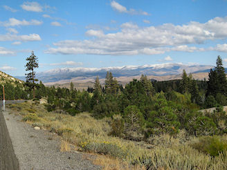 The nice scenery continued as I climbed a bit
before descending to Markleeville, a town of 200 known for its annual Death
Ride bicycle ride that challenges cyclists to climb three major passes –
Monitor, Ebbetts, and Carson – in a single day.
Markleeville is also the county seat of Alpine County, the least
populated county in
The nice scenery continued as I climbed a bit
before descending to Markleeville, a town of 200 known for its annual Death
Ride bicycle ride that challenges cyclists to climb three major passes –
Monitor, Ebbetts, and Carson – in a single day.
Markleeville is also the county seat of Alpine County, the least
populated county in
All of the National Forest campgrounds were closed for the
season. The
The room was actually kind of neat, not just another cookie cutter motel room. I ate next door at a bar/restaurant where it was Taco Tuesday night so I had tacos and a beer for a satisfying meal. The bar was a lively affair with various locals dropping by and engaging in animated conversation. I took my laptop to the bar to see if I could get WiFi which was available there but I could not connect to it. Back at my room I could connect to something called markleenet. When I first saw that I thought that was a service being provided by the town but when I attempted to connect I discovered I could only get 30 minutes of free connect time and would have to pay if I wanted more time. So I used 30 minutes and quit.
Day 31: Wed, Oct 07, 2009 - Markleeville , CA to Bridgeport ,
CA
I ate at the restaurant next door where I ate last night and had a rather mediocre breakfast of 3 pancakes and bacon. The pancakes were only medium size and nothing to get excited about. The only good thing was the waitress said she had inadvertently charged me for a short stack so I saved a $1. After breakfast I decided to take a photo of the town only to find a Caltrans truck kind of blocking the street. Then several more Caltrans trucks pulled into town and parked.
Since it was still a little chilly I waited until 9:30 to
leave. As I was leaving the Caltrans
trucks finally pulled out after sitting around for about 20 minutes. The first 5 miles out of town were really
nice following
After 5 miles I turned left on 89 to begin the climb to
Finally I crested the pass and was faced with some of the
best scenery of the tour, with  The scenery was so outstanding that I had to
stop a number of times on the steep descent to admire the scenery and take photos. At the end of the descent Hwy 89 finally
ended and I picked up Hwy 395 after seemingly having been on 89 forever.
The scenery was so outstanding that I had to
stop a number of times on the steep descent to admire the scenery and take photos. At the end of the descent Hwy 89 finally
ended and I picked up Hwy 395 after seemingly having been on 89 forever.
The ride now continued south through the valley and I
stopped in
I finally reached the Devil's Gate Summit and started a
nice descent into the
As I rode through town I checked out the motels. I stopped at a couple and found motels were no bargain in the $80 range. However, there was a hotel in town that advertised $40 rooms so I got one. I learned this motel, the Bodie Victorian Hotel, was moved from the ghost town Bodie and was decorated for the era. It was a small room but kind of neat with its distinctive decoration. However, it didn't have WiFi so I walked down the street to another motel that had a restaurant/bar where I ate and used their WiFi.
Day 32: Thu, Oct 08, 2009 - Bridgeport , CA to June
Lake
I ate at the restaurant next door that managed the hotel. I had a tall stack of pancakes which looked disappointing, particularly at first glance. They were smaller than medium sized but it turned out there were 5 of them. My guess is 3 of them might have made a large pancake so they were about equivalent to 2 large pancakes and they weren't cheap at $7. Another barely adequate breakfast.
When I looked around town a bit, which was easy because everything was on one fairly short stretch of road, I was surprised to see several of the motels with no vacancy signs. It was chilly and the weather prediction was for 40F by 9:00 so that was my target time. There was a grocery store that was selling everything 20% off but it didn't open until 9:00. When it did open I couldn't find any powdered milk and there selection of cereal didn't meet my preferences so I only bought a couple bananas and saved a whopping 20 cents.
It was hard leaving
Leaving
When I reached the summit I started a fast descent for a
mile or two and then I was hit by the extraordinary vista point with a view of  ,
from a thousand feet or so above the lake.
It was a spectacular view with the lake, the Sierras to the west and the
road snaking down to the lake level.
,
from a thousand feet or so above the lake.
It was a spectacular view with the lake, the Sierras to the west and the
road snaking down to the lake level.
It was a fast descent down to near lake level. Just before the town of
Lee Vining is a tourist town with a population of about
200. It is probably most noted for being
the turnoff to
I stopped by the grocery store again for something. I didn't find it but I met a forest service guy outside who turned out to be a touring cyclist too although he only managed time for 3-4 day trips. But he had some good info on the area and suggested a couple places tomorrow on the way to Bishop where I could get off the main highway for a while.
Finally, I left town for the 12 mile ride to
It was another 2 miles to the Oh! Ridge CG where I got a
site for $20, with pretty much my pick of any location with few campers
around.
Day 33: Fri, Oct 09, 2009 - June Lake ,
CA
It was cold over night. Towards the morning I was borderline cold in my sleeping bag but not enough to motivate me to put on more clothes. Then when I got up in the morning at 8:00, just when the sun was peeking over the mountain, it was already fairly reasonable, considering that the weather forecast originally predicted temps in the 30s at 9:00. So I was happy with that and didn't need the heavy duty gloves I thought I would need to get back to the store at the US395 junction. The store had a deli and I ordered a breakfast sandwich with ham. It was expensive at almost $10 with a carton of milk but it was very good and pretty sizeable on sourdough bread.
By the time I left at about 9:30 it was reasonable riding
temperature. I resumed the little climbing I had started
yesterday to Deadman Summit at 8,041 feet.
The climb lasted about 4 miles but I only had to climb about 400 feet so
it was a fairly modest climb. For a
while it looked like I had left the great scenery behind as I climbed through a
pine forest that hid the mountains but as I started a modest descent from the
summit I was riding directly towards the mountains at
I resumed the little climbing I had started
yesterday to Deadman Summit at 8,041 feet.
The climb lasted about 4 miles but I only had to climb about 400 feet so
it was a fairly modest climb. For a
while it looked like I had left the great scenery behind as I climbed through a
pine forest that hid the mountains but as I started a modest descent from the
summit I was riding directly towards the mountains at
After about another 5 miles,
The bike route climbed a bit to the Crowley Community and
I found myself riding by the Crowley Library which had WiFi so I stopped and
dealt some more with some work issues.
The road then climbed steeply for about a half mile giving a better view
of
Just after Tom's Place I was routed back onto US395 for a
mile or two and another sign directed cyclists to
The
When
Once I reached Bishop around 3:00 I made a pass through
town and saw the usual tourist sights – motels and restaurants. I circled back and stopped at the Info Center
where I learned motels would not be cheap, with $70 about the least expensive,
but I didn't realize at that point that $70 would have been a great deal. I had noticed on a map that Bishop had a town
park and I erroneously thought that was a camping place. However, the
Shortly after 5:00 I rode to a burrito place and had as much as I needed to eat with a burrito meal and then headed out to find my free camping. Unfortunately, I think I missed my canal landmark and went further than I should have because what I found didn't look like a camping spot. In fact, there was a car already parked there and I suspect this might have been a lovers lane and the folks in the car left, probably after it looked like I was taking up residence. I couldn't find a decent place to throw up a tent and I was getting eaten by mosquitoes, the first mosquitoes of the trip who I would have thought were gone for the season. I finally decided this was probably not the free camping place so I started riding back to town. On my way back I passed another canal which seemed more likely to be the canal landmark I was told about but I didn't see the turnoff I was told about.
So I continued into town, resigned to a motel. I stopped at a motel off the main drag and was offered the last room for $70 but it was a smoking room. I was pretty sure that was the best price I was going to see, especially when the motel proprietor noted this was Lone Pine File Festival weekend and said Bishop was getting the overflow that couldn't be handled in Lone Pine. That made me really happy since it meant tonight was harder to get a motel and tomorrow night, when I had planned to be in Lone Pine would be even harder. It was times like this when I wished weekends could be eliminated. Anyway, I started riding around town in the dark with my bike lights and visited several other places. My other top choice for the least expensive place already showed no vacancy. About that time I decided maybe I shouldn't be so averse to a smoking room and headed back to the original motel which now showed no vacancy.
Then I started checking the name motels like Motel 6 and they were all showing no vacancy. Overflow folks had probably already reserved rooms at these name motels. Finally, I stopped at a Rodeway Inn, knowing it wasn't going to be a great choice, and wasn't disappointed when I learned it was $109. By that time I figured I had to bite the bullet and write off the night as the one bad night a trip I somehow get stuck with a really expensive motel. But the experience wasn't over yet. After I cleaned up I noticed an ash tray with ashes in it. I was used to always being advised about or asked about smoking rooms but not this time. So I complained and suggested I should get a discount. The young lady behind the counter wasn't really prepared to handle something like this but eventually managed to contact the owner who offered a $10 discount. I responded that wasn't enough for getting stuck in a smoking room and that I would make a full blown complaint to Rodeway Inn if $10 was all that could/would be done.
But it wasn't over yet. I went back to my room at least determined to use the WiFi only to find that no Rodeway WiFi was available. I tested with my PC and found I could get the WiFi in the parking lot and in the office but not in my room. So I pointed that out to the young lady behind the desk who was probably wishing at that point that I had never shown up. I figured that getting stuck in a smoking room with no WiFi would give me some leverage one way or the other. In any evnt, quite an adventure going from free camping to a $100+ smoking room with no WiFi in the space of a couple of hours.
Day 34: Sat, Oct 10, 2009 - Bishop, CA to Big Pine, CA [21.9, 1:48:47, 12.1 mph, 175']
The Rodeway Inn continental breakfast was pretty miniscule. I had a very small bowl of cereal and half of a muffin – just what you would expect after spending $100 for a room. Yesterday when we had the dispute about being stuck in a smoking room without choice, the young lady reversed my credit card transaction so I needed to pay for my room. When I told the guy I was checking out, he ran my card through the machine and it came out to $99, so they ended up granting me a $20 refund as I had asked. But it turned out that was not the end of the saga. After the trip, I discovered I got billed twice for that amount. Fortunately, that was pretty obviously an error so my VISA card had no problem getting the extra charge eliminated.
I hadn't slept very well last night, nothing to do with the room, so I got to thinking that it probably didn't make any sense to ride to Lone Pine on a Saturday of the festival. So my goal was to ride to Big Pine, which would get me a little closer to Lone Pine but hopefully without having to worry about accommodation since there were two campgrounds in the area that would work for me. So I planned to spend most or all of the morning in Bishop before riding to Big Pine. My first stop was a return to the Loonie Bean coffee shop where I used their WiFi for a couple of hours.
When I couldn't sleep last night I decided to finish off the John Gresham novel, The Broker, which seemed like I had been reading forever. Despite the glowing recommendations for the book I didn't find it all that interesting until the last 50-100 pages. But now I needed another paperback and the folks in the coffee shop told me about a used book store just down the street and a block off the main street. There I picked up another paperback for half price, $4, and donated my old paperback since I would have just thrown it away otherwise. Then I grabbed a bite to eat at a food mart to augment my meager continental breakfast and took off.
At the south end of town I discovered a campground where
it seems I should have been able to camp last night. I didn't see any sign that suggested it was
full and wondered why the receptionist at the
It was an easy ride to Big Pine, only about 15 miles where
I thought it was 20 and it was slightly downhill so I rode 15-18 mph. US395 continued down the  and the
Big Pine had a pop of 1,450 at 4,000 feet. There was less to it than I expected for that size, several motels, several food marts, a grocery store, and a couple of restaurants. There was a campground on the edge of town where I entered where I got a tent site for $12. It wasn't a great campground but it was mostly empty and it was a heckuva lot better deal than a $100 motel room. After staking out my spot I rode back into town to a cafe for a barbeque beef sandwich, lingering over my meal since I didn't have much to do for the day.
When I got back to the campground I took a nap. I was rather tired since I hadn't slept well last night. After a refreshing nap I spent a couple of hours on bicycle maintenance. I cleaned my chain and replaced my front brake pads which were almost gone, not a big deal since I carried a spare set of brake pads.
I rode back into town for another bite to eat and settled into camp. Like last night when I was hunting for the free camp spot the mosquitoes came out so I quickly retired inside my tent for the night.
Day 35: Sun, Oct 11, 2009 - Big Pine, CA to Lone Pine, CA [49.5, 3:59:36, 12.4 mph, 1,285']
It was a good night for sleeping with cool weather. I didn't need to zip up my sleeping bag until
maybe 4 am when it got pretty chilly. In
the morning there was a great view of the
I ate at the cafe in town and had good pancakes, nice and fluffy and fairly large. Interestingly, according to the menu a stack of 3 pancakes cost $0.20 more than a stack of 2. Seemed like that had to be a misprint. This cafe looked to be pretty popular and it was about full when I left around 8:45.
It was an easy 40 mile ride to Lone Pine with the road
slightly descending and I averaged nearly 15 mph. The Sierras were just wonderful as they
ascended from the valley floor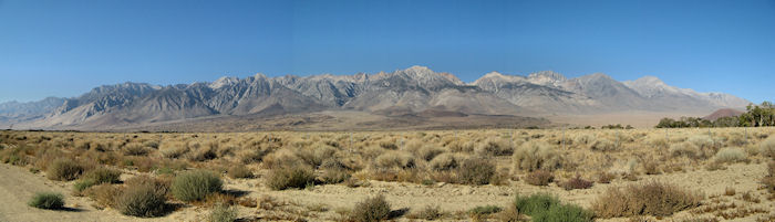 and the
I stopped at a food mart/casino just before
US395 had been such a good road shoulder-wise that I had
forgotten what bad shoulders were like but I got reminded. The road was under repair through
When I rode into Lone Pine, pop 2050, I was surprised to find people lined the streets waiting my arrival. It was nice of them to do that and I guess since they were already out most of them decided to hang around and check out the Lone Pine Film Festival parade as well. The parade was scheduled to run from 12-2 and I arrived around 12:30. So I decided I might as well watch the parade too.
Before and during the parade I got to talk to a couple
folks. One guy was from
Another guy was from
After the parade I found a coffee shop with WiFi and checked email and browsed the Internet for a while. There was a hostel in town that advertised $20 beds as a skiing special so I decided to check it out since hostels sometimes have private rooms. This one did but they wanted $67 which was no bargain for me. So I ate at a Pizza Factory and then headed for the Alabama Hills. There was a campground about 4 miles back in the hills and places where folks told me I could just pull off the road and camp.
I started riding back into the hills a little before
5:00. It started out as a modest climb
for the first half but then got pretty steep.
This road was the
At the
Day 36: Mon, Oct 12, 2009 - Lone Pine, CA to Panamint Springs , CA
After packing up it was an easy 3 miles back to town,
descending 700 feet. I did a quick tour
through town and found two places open for breakfast. One didn't have any customers so I selected
the other – Mt Whitney Restaurant. There
were only a couple in the restaurant but by the time I left it was almost
full. I had their Cowhand Special – ham,
eggs, 3 pancakes and it was one of the best breakfasts of the trip. After eating I picked up food at the grocery
store, my last opportunity for a real grocery store until I got through
It was about 8:45 when I left town. About a mile south of town I picked up 136
towards
In a while I came to Keeler, pop 50, too small to have any kind of store so I pulled off just past Keeler at a historical marker so I could use the marker rock to sit on for my second breakfast. At one time Keeler was a town of 5,000 that was the trade center for the Cerro Gordo Mines, once an active silver-lead bullion mining area. Now Keeler was a dying town. There were several signs near the road advertising lots for sale that no doubt were inexpensive.
It was a cool day with cloudy skies so temps weren't a
problem but there was some headwind which also kept it cool. After 24 miles I rode through a notch in the
mountains and left the
Not too long after cresting at 5,200 feet I came to a
turnoff with a view of 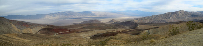 The tip of the peninsula looked over the
After gasping at the view for about 15 minutes I retreated back to the road and started the approximate 3,000 foot descent. The grade was modest enough that it didn't require a great deal of braking to keep the bike under control. It was just an awesome ride after previewing the route down to the valley and then riding it.
At the bottom was Panamint Springs, a resort area in
After setting up and showering I walked back to the restaurant to write my notes. I tried to order an Alaskan Amber beer but was told it wasn't available yet despite the neon sign so I had a Firestone DBA instead. I was asked whether I wanted a small, medium, or large and ordered a medium which was about 2 regular beer cans in size – plenty of beer for me.
Tomorrow is going to be a questionable day. The west coast is being hit by the remnants
of the typhoon that hit
During the day’s ride my cyclocomputer started acting erratic again. I assumed it was time to replace the transmitter battery but that didn’t fix the problem. So I replaced the receiver batter again, having replaced it early in this tour, and that fixed the problem.
Day 37: Tue, Oct 13, 2009 - Panamint Springs, CA to Stovepipe Wells, CA [32.6, 3:47:20, 8.6 mph, 3,373']
My goal was to get going earlier than normal today because there was a possibility of showers in the afternoon. I had a big climb ahead of me to 5,000 feet and I wanted to get that out of the way in the morning. It was cloudy in the morning and around 7:00 the sunrise was very nice as the sun displayed its colors against the clouds in the mountains in the east.
I ate at the restaurant and had a rather ditzy waitress, unlike last night where the waitress just knew how to handle everything efficiently. I had to remind my waitress to bring me coffee and then cream after I had initially told her I wanted coffee with cream. Nevertheless, the bacon, eggs, and 2 pancakes were fine, just expensive. I was also able to use the WiFi and handle a few things.
I left town about 8:15.
I had to first cross the
Initially the climbing was reasonable but then much of the rest of the climb of 12 miles or so found me climbing mostly at 3 mph. It was a twisting climb to find a way through the mountains and there were some great views looking back across the valley and seeing the road snake up the mountains. It also got chillier with the altitude and it was fairly breezy.
I stopped at one turnout and a guy there offered to take
my panniers but I declined on principle.
About 10:30 I found a spot where the road cut between two hills where
the wind was moderated some and there was a convenient rock to sit on for my
second breakfast. It was chilly enough
that I put on my jacket. Much of this
climb was steep enough that getting started from a stop required riding sideways
to get going. But it was a scenic climb,
both following the route through the mountains and looking back across the valley. As I
neared the top the wind was channeled through the route slot and helped a fair
amount since it was a tail wind. Then
mercifully the climb eased off for the last 1.5 miles and topped out at
and looking back across the valley. As I
neared the top the wind was channeled through the route slot and helped a fair
amount since it was a tail wind. Then
mercifully the climb eased off for the last 1.5 miles and topped out at
However, as soon as I started the descent I felt a few
drops of rain. As I continued the
descent the few drops became a drizzle.
It actually wasn't that bad but the combination of wind chill from 25-30
mph descent along with the force of the rain hitting me at that speed made the
drizzle effectively worse than it was.
Since the drizzle didn't look like it was going to stop and perhaps
intensify I stopped to put on my rain gear.
Ironically, the first use of my rain gear while riding was in, of all
places,
The rain gear helped to make the descent more comfortable
but it didn't do anything for the scenery.
Most of the scenery was very hazy and I could barely see
Near the bottom of the descent I met another touring
cyclist, Neal from
I rolled into Stovepipe Wells sometime before 2:00 and
wandered around and got a bite to eat. I
could have continued on to Furnace Creek since it was only another 30 miles and
flat but I chose not to because of the weather.
There was still the potential for rain both today and tomorrow. Once I reached Furnace Creek, I would be
faced with a 75 mile ride to Shoshone which also required climbing out of the
valley. So I wanted a good day for
that. Thursday was supposed to be a good
day insofar as no rain but the temperature was supposed to get up into the
mid-90s. Then Friday was supposed to get
even hotter. Wednesday carried the
potential for rain in the morning and possibly some headwind. So my choice to ride to Shoshone was
Thursday. That meant a short day today
and a short day tomorrow, which would help me work around any rain. It would also allow me to spend some time at
the
After satisfying my hunger a bit I found a place to plug in my PC and tap into the WiFi for a while. Then I moved to the campground where I got a site for $12. For a National Park this was a pretty reasonable fee where I am accustomed to pay on the order of $20. However, compared to last night's $7.50 bargain that included a shower, this wasn't a great deal. The campground itself certainly wasn't a charmer. It was basically just a gravel parking lot, although in some fairness, there wasn't a whole lot to work with in this desert land. The good thing was that tent only sites were lined on the northern boundary of the campground and it was even possible to move out a bit and set up a tent among the shrubs. I chose not to do that because I locked my bike to the picnic table and I didn't want my tent very far away.
Later I found the Stovepipe Wells food service rather lacking. The restaurant served breakfast but then closed until 6:30 for dinner. I wasn't interested in waiting until 6:30 but the bar opened at 5:30 so I checked it out. They, however, only served appetizers and I wasn't interested in that. So I ended up going to the store and grabbing a chicken sandwich and chips. That was good enough for me and certainly less expensive than the restaurant or the bar, if it had served real food.
Day 38: Wed, Oct 14, 2009 - Stovepipe Wells, CA to Furnace Creek , CA
It was a windy night with blowing sand. It was fairly warm so I wanted to keep part of my vestibule open for ventilation but I couldn't do that because of the blowing sand. Even with my vestibule closed the sand got blown under the edges of the vestibule and the finest sand made it through the mesh covering between me and the vestibule. There was fine sand scattered throughout the tent. It was also warm enough that I didn't need my sleeping bag. I simply laid on top of it. Fortunately, after maybe a couple of hours the wind finally abated and the rest of the night was peaceful if warm.
When I got up in the morning with the rising sun the
sunlight shining against the mountains to my west was spectacular coloring.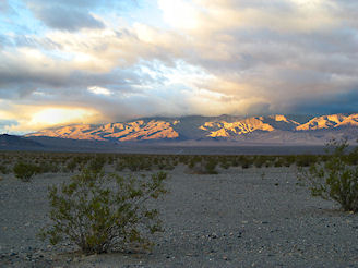 I rode the short distance to the restaurant
for breakfast. The restaurant only had a
buffet breakfast but that was fine by me.
There wasn't a great deal of variety but the only thing really missing
was pancakes or french toast. Instead I
chowed down on cereal and bacon and eggs and some pastries. It was a pretty good deal for $10.
I rode the short distance to the restaurant
for breakfast. The restaurant only had a
buffet breakfast but that was fine by me.
There wasn't a great deal of variety but the only thing really missing
was pancakes or french toast. Instead I
chowed down on cereal and bacon and eggs and some pastries. It was a pretty good deal for $10.
After breakfast I checked the Internet for a bit and then hit the road around 8:30. There was a prediction of possible rain in the mountains and there were some fairly heavy clouds hanging over the mountains. Otherwise, the weather was pretty good although it was already warm and I started riding in my shorts with my long sleeve shirt for sun protection. There was also a fair headwind which helped to keep me cool. It also slowed me down some but I only had a short distance to Furnace Creek so that wasn't much of an issue.
There were a lot of good views today. This was aided by the clouds which caused shady patterns in the mountains. The route headed northeast across the valley and then southeast and south along the eastern side of the valley. My GPS showed -260 feet on a couple of occasions which was pretty low but the low point was in Badwater which I wouldn’t see until tomorrow.
For a relatively short ride I seemed to get pretty thirsty. It was warm but not as warm as predicted for tomorrow so that made me wonder how I would fare tomorrow on a much longer, more difficult ride in warmer weather. I arrived in Furnace Creek around noon. The first thing I did was stop at the store and gulp down a large sports drink. Normally, you can't get any sports drink in the fountain drinks but this place had PowerAde and I ended up downing two cups of 32 oz. I also downed a dish of soft ice cream from their machine. That pretty well made me whole again.
After that I rode back to the
While I was browsing away two other cyclists rode up and park their bikes next to mine. One had a recumbent with 2 small rear panniers and the other had an unloaded bike but was carrying a day pack. They had just ridden in from Pahrump which is something like a 90 mile ride. I presumed they were staying in the motel and they went off to eat in the cafe.
A little while later I grabbed a bite to eat from the
store and another PowerAde and then headed to the campground. It was a big campground and sites were
divided by tent walk-in sites, regular tent sites, and RV sites. The main season in
Day 39: Thu, Oct 15, 2009 - Furnace
Creek , CA
It was not a good night for sleeping. It was too warm in the tent. Outside the tent it was probably okay. I maximized the ventilation in the tent by opening both half doors of both vestibules and that helped but it wasn't good enough. Wearing only underpants I lay on top of my sleeping bag, too warm for comfortable sleeping. Towards morning it cooled off more and I finally needed to use my sleeping bag a little.
I got up early to try to get as early a start as possible. Today promised to be a hard day with the temperature expected in the mid-90s and nearly 4,000 feet of climbing, mostly in the afternoon. The village had a breakfast buffet for $12.23 that was a couple dollars more than the Stovepipe buffet but it was a better buffet. It had more variety and more importantly it had French toast and waffles. So I had typical breakfast stuff plus French toast/waffles plus cereal. I loaded up because I was sure I could use the calories and I drank up because I wanted to be well hydrated.
I left right around 8:00 in a comfortable
temperature. I planned to ride down
It was a nice ride down the east side of  was named when a miner tried to get his pack to drink but the animals refused
because the water was too salty, so the miner called it “bad water”.
was named when a miner tried to get his pack to drink but the animals refused
because the water was too salty, so the miner called it “bad water”.
It was a good road to Badwater but after Badwater the road
had numerous horizontal cracks. All the
cracks were filled but they provided a somewhat rough passage on a
bicycle. This continued for about 15
miles and then relatively new pavement took over. At that point a sign warned about a rough
road which was smoother for me than the previous 15 miles. Somewhere along this stretch I was lucky
enough to see a kit fox along the road.
This was surprising since the kit fox is supposedly nocturnal, as are
many animals in
In the morning the temperature was generally okay but there was no protection from the sun. With no trees around, there was almost no place to find shade for a break. Near the end of the valley there was a ruin and a turnoff where there was a john. I didn't need a john but I found that the john provided a shady area for a break. The john also provided some smell so it wasn't the greatest place for a break.
After the break it was only a few miles more before the road curved to the east and began the climb out of the valley. This was around 1:00 which, of course, was when the heat was building up. There were times when there was a slight breeze that helped keep me cool but the breeze was fleeting. I did find one place where a large rock provided a shady area and I took advantage of that for a break. I had also used up my 2 water bottles that I carried on the bike frame and started tapping the water bladder.
It was a steep climb and I climbed mostly at 4 mph. There were 2 passes to climb. The first was
I was really dragging by the time I finally reached the pass around 4:45, just willing my body to keep turning the pedals because that was the only thing that was going to get me to the pass. From the pass it was a nice 4 mile descent into some more nice mountain scenery. The road did flatten out and it actually went up at a slight grade for a couple of miles and then descended again all the way to its junction with 127. From there it was about a mile to Shoshone, pop 100, my destination.
Shoshone had a motel, food mart, cafe, and grocery store. I immediately went to the food mart and guzzled a 44oz soda to bring my fairly exhausted body back to life. I expected to stay in a motel but the motel wanted $73 for a room so I returned to the RV Park I saw just outside Shoshone and got a tent site for $20. It wasn't a great deal. There was a grassy area for tents which was good but no picnic table beyond the 2 tenters who were already there. I had to drag a picnic table from another location. However, a shower was included in the price so I enjoyed my first shower in a couple of days.
After setting up, I rode my bike the quarter mile back to the cafe in town and had a burrito meal which was okay. I also drank a lot of soda. Fortunately, soda was unlimited refills and the poor waitress earned her money just refilling my drink nearly constantly. Then I rode back to camp using my bike's lights since it was dark.
Day 40: Fri, Oct 16, 2009 - Shoshone, CA to Pahrump , NV
I slept terrible, didn't hardly get any sleep and I don't know why. Given that yesterday was a hard day I would have expected to sleep like a baby. Sometimes when I sleep poorly I catch some good sleep late in the morning but that didn't happen either. Instead I got up around 6:00 which didn't do a lot of good since the cafe didn't open for breakfast until 8:00. So I got to the cafe around 7:30. Fortunately I found a WiFi spot and I was able to get some Internet time in. Then I had a decent breakfast of pancakes, egg, and ham.
When I left town near 9:00 I rode just a short way and
then picked up 178 again heading northeast.
It was a steep climb of almost a 1,000 feet to get out of the
valley. There was a surprising amount of
traffic on the road but I guess many folks were headed to  and the descent I made coming down from the
From the top there was a modest descent and then the start
of a more gradual climb of about 6 or 7 miles.
Like yesterday there really wasn't any good place to stop along the way
so I finally just picked a spot by a bush that provided a little shade and had
my second breakfast. My goal for the day
was Pahrump, just over the
After reaching the top of the second climb I had a modest
descent for a few miles and then shortly reached the
I could see Pahrump spread out below from a distance and it seemed to take forever to reach the real part of the town. When I got reasonably close I stopped and guzzled a 44 oz soda and that was much better than drinking my warm water. There was a stop light in town where 178, now called 372, intersected with 160 and 160 was the main drag. Coming into town I knew very little about Pahrump but I soon learned what it was primarily about – gambling. There were several casinos along about a mile stretch and that seemed to be the heart of the town. I rode part of the main stretch and noted that there weren't any regular motels in this stretch, just motels catering to the gambling.
I stopped and asked about a coffee shop with WiFi so I could research the area a bit and got directed to the local library which was probably a better choice. Googling at the library I soon discovered that the gambling motels were it. I checked a couple out to see what prices looked like and it looked like everything might be booked on this Friday. I quickly got a bad feeling about the motel situation. There were some RV Parks but the RV Parks were almost certainly catering to the gambling as well and I didn't see any hint of tent sites.
So I packed up at the library around 2:30 and figured I better hit the road and see what kind of quandary I was in. There was a Best Western that looked like it would have been reasonably priced if anything was available so I decided to start my search there. I had little confidence that I would get lucky but I figured I would be able to glean some info about other motels there. When I got to the front desk the receptionist was on the phone. I could just imagine that there had been a cancellation and she was offering the cancellation to the lucky caller. Instead, she told me that there were a couple of rooms available, apparently due to last minute cancellations, and I was rather lucky to get a room for $72. It was on the second floor and I had to carry my loaded bike up the steps but I was more than happy to do that at that point.
After settling in I was able to walk to a Laundromat across the street from the motel and do some badly needed cleaning. The motel had a sports lounge that offered pizza so I ordered a takeout pizza and that took care of my food needs. My room had good WiFi service so I took advantage of that too.
![]()

![]()
Copyright
Denis Kertz, 2009. All rights reserved.